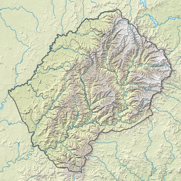
Fail:Lesotho rel location map.svg
Ilme

Selle SVG-faili PNG-vormingus eelvaate suurus: 600 × 600 pikslit. Teised eraldusvõimed: 240 × 240 pikslit | 480 × 480 pikslit | 768 × 768 pikslit | 1024 × 1024 pikslit | 2048 × 2048 pikslit | 765 × 765 pikslit.
Algfail (SVG-fail, algsuurus 765 × 765 pikslit, faili suurus: 770 KB)
Faili ajalugu
Klõpsa kuupäeva ja kellaaega, et näha sel ajahetkel kasutusel olnud failiversiooni.
| Kuupäev/kellaaeg | Pisipilt | Mõõtmed | Kasutaja | Kommentaar | |
|---|---|---|---|---|---|
| viimane | 13. märts 2017, kell 23:20 |  | 765 × 765 (770 KB) | NordNordWest | == {{int:filedesc}} == {{Information |Description= {{de|1=Positionskarte von Lesotho}} {{en|1=Location map of Lesotho}} {{Location map series N |stretching=116 |top=-28.3 |bottom=-31.0 |left=26.9 |right=29.6 }} |Source={{Own using}} * United States Nat... |
Faili kasutus
Seda faili kasutab järgmine lehekülg:
Globaalne failikasutus
Järgmised muud vikid kasutavad seda faili:
- Faili kasutus vikis ar.wikipedia.org
- Faili kasutus vikis ast.wikipedia.org
- Faili kasutus vikis az.wikipedia.org
- Faili kasutus vikis bg.wikipedia.org
- Faili kasutus vikis bn.wikipedia.org
- Faili kasutus vikis bs.wikipedia.org
- Faili kasutus vikis ceb.wikipedia.org
- Faili kasutus vikis ce.wikipedia.org
- Faili kasutus vikis cs.wikipedia.org
- Faili kasutus vikis da.wikipedia.org
- Faili kasutus vikis de.wikipedia.org
- Thabana Ntlenyana
- Lesotho
- Katse-Talsperre
- Maletsunyane-Wasserfall
- Vorlage:Positionskarte Lesotho
- Wikipedia:Kartenwerkstatt/Positionskarten/Afrika
- Sehlabathebe-Nationalpark
- Mohale-Talsperre
- Karoo-Ferrar-Magmaprovinzen
- Ts’ehlanyane-Nationalpark
- Königlicher Palast (Lesotho)
- Maboloka (Berg)
- Likhoele
- Makoaneng
- Sefikeng (Berg)
- Sefikaning (Berg)
- Benutzer:Shi Annan/Koeneng
- Tlapaneng
- Thaba Bosigo
- Faili kasutus vikis de.wikivoyage.org
- Faili kasutus vikis el.wikipedia.org
- Faili kasutus vikis en.wikipedia.org
Vaata selle faili globaalset kasutust.


